India Pakistan heating up.
-
I think it's fair to say the Brits made a bit of a mess of things. If you look at the map in the 60's, East Pakistan (now Bangladesh) and West Pakistan look absolutely ridiculous. I had some friends who were Kashmiri Pakistanis, and they would regularly harangue me about this as though I was personally responsible.
-
Some friends.
I wonder how much cultural blindness had to do with many of the partitions of de-colonization. Seems like a great idea to the admittedly ethnocentric Brits, never considering whether it would be accepted by the partionees.
-
Some friends.
I wonder how much cultural blindness had to do with many of the partitions of de-colonization. Seems like a great idea to the admittedly ethnocentric Brits, never considering whether it would be accepted by the partionees.
@Mik said in India Pakistan heating up.:
Some friends.
I wonder how much cultural blindness had to do with many of the partitions of de-colonization. Seems like a great idea to the admittedly ethnocentric Brits, never considering whether it would be accepted by the partionees.
Well, they tried the same thing with Ireland in 1921, and that worked a treat, so what could possibly go wrong?
-
The Pakistan line was drawn through Punjab. Punjab was the location of the last independent Indian empire that fell to the British.
About 12-20 million people were displaced and some estimate up to 2 million deaths from resulting violence and deprivation.
The line was so ineptly drawn that the founding temple of the Sikh faith ended up in Pakistan. (Sikhism comes from Punjab).
The apocryphal story is that Lord Mountbatten couldn't take the Indian summer heat and just drew a line through villages and cities as fast as he could.
-
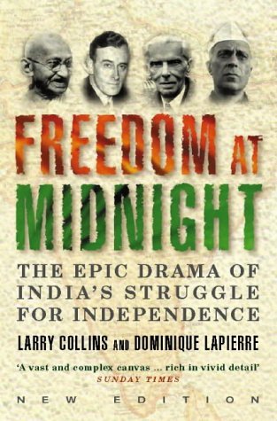
I thought a good book about the "partition" was Freedom at Midnight.
It has been few years since I have read it, but I remember that it seemed to give a good overlook of the events.
-
Great top comment. "Ziplining while staring into your device. The faint sounds of bombs going off in the distance. This is 2025."
-
-
Lo, no accord shall bloom 'twixt us and that realm, save they do kneel in token of their utter, soul-deep shame! No parley shall we hold, no treaty sign, until their will is broken, and their strength doth lie as dust before our might. -DJT, 3/6/26
-
The consensus on that thread is India will crush them. Swell.
Islam just keeps making trouble in the world.
-
-
surprised that last video hasn't been taken down with the VOA losing its funding and all that. :eek
-
They're much like birds dancing to seek a mate. But you can see the British influence in the ceremonies.
@Mik said in India Pakistan heating up.:
you can see the British influence in the ceremonies.
You certainly can...

Hello! It looks like you're interested in this conversation, but you don't have an account yet.
Getting fed up of having to scroll through the same posts each visit? When you register for an account, you'll always come back to exactly where you were before, and choose to be notified of new replies (either via email, or push notification). You'll also be able to save bookmarks and upvote posts to show your appreciation to other community members.
With your input, this post could be even better 💗
Register Login