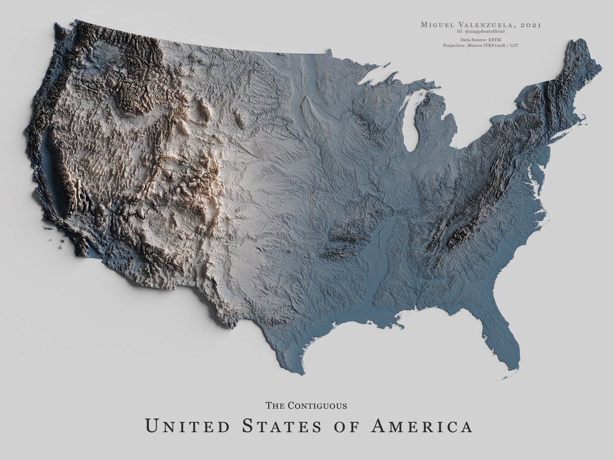
Interesting topographical map of CA
-
The best drives in California are the east west crossings of the sierras. Often closed in winter.
Before corona I did a drive in late October between Death Valley crossing the mountain ridge on rte 178 into Bakersfield. Did the southern route because the more northerly routes had snow.@bachophile said in Interesting topographical map of CA:
The best drives in California are the east west crossings of the sierras. Often closed in winter.
Before corona I did a drive in late October between Death Valley crossing the mountain ridge on rte 178 into Bakersfield. Did the southern route because the more northerly routes had snow.I did it a tad south through the Mojave desert to Bakersfield and on to San Luis Obispo that same month - Oct 2019
Person. Woman. Man. Camera. TV.
-
I drove from Vegas to the central coast two years ago, it really brought home the idea of the 'Central Valley'.

@jon-nyc said in Interesting topographical map of CA:
I drove from Vegas to the central coast two years ago, it really brought home the idea of the 'Central Valley'.
Super cool map. I've spend many boring hours driving up and down the valley.
I have very positive associations going over the mountains though (usually meant I was going somewhere fun - Tahoe, LA, Oregon, etc.)
-
@bachophile said in Interesting topographical map of CA:
The best drives in California are the east west crossings of the sierras. Often closed in winter.
Before corona I did a drive in late October between Death Valley crossing the mountain ridge on rte 178 into Bakersfield. Did the southern route because the more northerly routes had snow.I did it a tad south through the Mojave desert to Bakersfield and on to San Luis Obispo that same month - Oct 2019
@jon-nyc I went north of SLO and stayed in Cambria. Very nice little town. And then on up Big Sur to SF. Nice drive.
I love long distance driving. Always have. That’s why I’m planning now my florida Dallas trip in March. I have a medical conf in Dallas. Seems like life is slowly returning to normal.Anyway. I have a son, and two sibs living in the Bay Area. So I guess it’s sort of a second home.
-
This map also sets up a good analogy for why San Francisco is colder in the summer months than late Spring / early Fall.
The valley is like a hot room - and the Golden Gate is the only big opening in the coastal mountain range. It acts like a door.
San Francisco is directly in the path of the open door. The hotter it gets in the "room" (valley) the more cold air gets sucked over San Francisco.
I'm sure I butchered that at made it pseudosciency - but it's how I explained it to myself anyways.
@xenon I hunk that’s why the gate is a fog machine
Hello! It looks like you're interested in this conversation, but you don't have an account yet.
Getting fed up of having to scroll through the same posts each visit? When you register for an account, you'll always come back to exactly where you were before, and choose to be notified of new replies (either via email, or push notification). You'll also be able to save bookmarks and upvote posts to show your appreciation to other community members.
With your input, this post could be even better 💗
Register Login