Cool finds on maps
-
One of my best (worst) ways to spend some time is to explore remote areas on Google Maps using the satellite view... hopefully there's a street view, or pictures of a restaurant that is 200 miles from the nearest gas station (I found one gas station where it is MANDATORY to fill your car up before you travel further north due to the desolation).
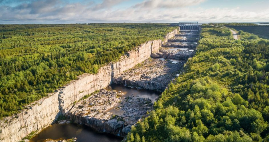
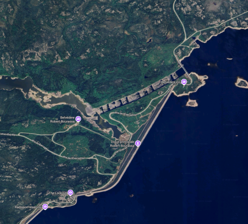
Anyway, I found this just now. Cool! Any guesses as to what it is? (It's not a trick question)
-
I guess I've started threads like this before, and you're always kind enough to indulge me, LOL. https://nodebb.the-new-coffee-room.club/topic/37597/moar-geography?_=1753798729666
-
-
This image appears to show a massive stepped spillway or canal channel carved into bedrock, likely associated with a hydroelectric dam or water control structure. The tall structure at the far end looks like a dam with sluice gates, which would control the release of water from a reservoir upstream.
The stepped, terraced design and rock-cut sides suggest it’s engineered for high-volume water flow while minimizing erosion — a common design for spillways or tailrace channels in large hydroelectric systems. The structure is currently dry or has minimal water flow, indicating it may be seasonal or undergoing maintenance.
@jon-nyc said in Cool finds on maps:
This image appears to show a massive stepped spillway or canal channel carved into bedrock, likely associated with a hydroelectric dam or water control structure. The tall structure at the far end looks like a dam with sluice gates, which would control the release of water from a reservoir upstream.
The stepped, terraced design and rock-cut sides suggest it’s engineered for high-volume water flow while minimizing erosion — a common design for spillways or tailrace channels in large hydroelectric systems. The structure is currently dry or has minimal water flow, indicating it may be seasonal or undergoing maintenance.
Thank you, ChatGPT.

Hello! It looks like you're interested in this conversation, but you don't have an account yet.
Getting fed up of having to scroll through the same posts each visit? When you register for an account, you'll always come back to exactly where you were before, and choose to be notified of new replies (either via email, or push notification). You'll also be able to save bookmarks and upvote posts to show your appreciation to other community members.
With your input, this post could be even better 💗
Register Login