The ‘LA fire is a tragedy’ thread
-
The Easton fire is getting close to Sierra Madre where a lot of my friends lived. Janet and her sister just flew to LAX this morning, but headed to Orange County.
-
Crazy shit man. New fire in Hollywood hills.
Pacific Pallisades 75% gone. Even parts of Santa Monica evacuated.
@jon-nyc said in The ‘LA fire is a tragedy’ thread:
Crazy shit man. New fire in Hollywood hills.
Pacific Pallisades 75% gone. Even parts of Santa Monica evacuated.
A meeting got cancelled for me yesterday because one of the attendees was in her car evacuating.
I had a course to cover today and we had to cancel at the last second because the person setting up the recordings got a notification on her phone to leave her shit where it was and get the hell out immediately.
Both are fine now but it was wild. One's staying at a friend of a friend of a friend's along with half a dozen other strangers about 2 hours away.
-
I don’t know really anything about “where things are” in LA. That being said, the videos are remarkable. From inside houses surrounded by fire, to the passengers filming while flying out of LAX, etc. Again I don’t know anything but presume it’s a big mix of extremely expensive celebrity homes, regular homes, and hillsides.
https://www.reddit.com/r/interestingasfuck/s/HRQwPeUp5m
Before:
https://www.reddit.com/r/interestingasfuck/s/sMPBItOikN
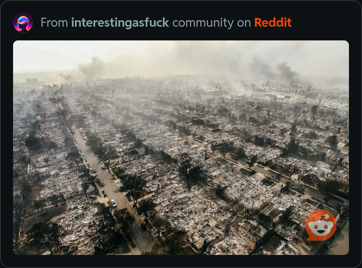
After:

-
There is a lot of blame being tossed around, and I have to wonder how much of the criticism is valid. That said, I'll keep an open mind and wait for a "non-governement fuck-up" explanation for empty hyrants.
Arson? I saw a video done by someone stopped at a stoplight, and he caught someone setting a fire.
-
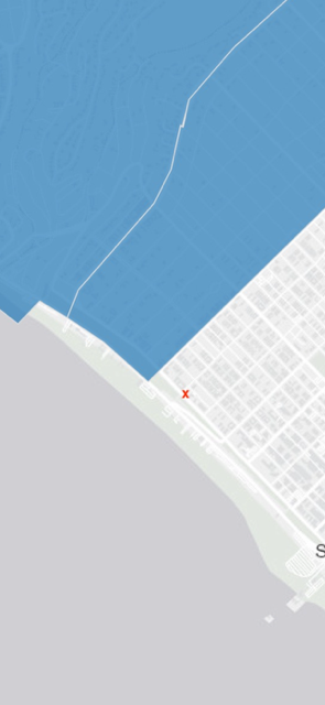
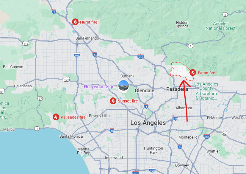
Can you zoom that out a bit so we can see where it is relative to the coastline? I assume it’s pacific pallasades.
@jon-nyc said in The ‘LA fire is a tragedy’ thread:
Can you zoom that out a bit so we can see where it is relative to the coastline? I assume it’s pacific pallasades.
Western Altadena.
From reddit:
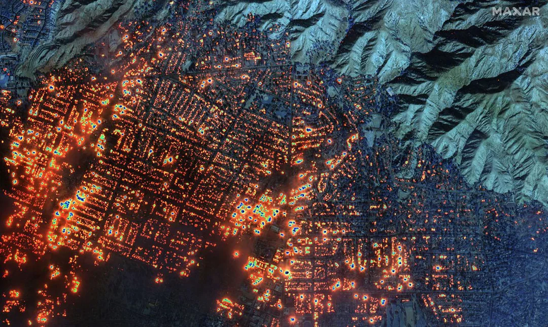
New satellite images from Maxar Technologies are giving the best view yet of just how many buildings are on fire in the Palisades and Eaton wildfires in Los Angeles.
The images were taken at 10:45 a.m. PT, during a time of significant cloud cover across the Los Angeles area.
Because of that, they are a mix of shortwave infrared and visible satellite images. Shortwave infrared sensors on Maxar’s satellites allow them to detect more things on the ground than are in the visible light spectrum – which is visible to the naked eye – such as heat signatures.
Everything illuminated in orange or white indicates locations where fire has been detected.
The imagery shows the Eaton wildfire has set nearly every building in western Altadena on fire. From the Altadena trailhead to the Mountain View Cemetery, the shortwave infrared sensor shows nearly every block is on fire. Those fires continue nearly all the way to Altadena’s east.
-


